Okunikko by Car: Reaching the Plateau Most Tourists Never See
The bus to Senjogahara arrives at 7:15 AM. Sunrise is at 4:25. That gap isn't inconvenience — it's total exclusion from the plateau's best moments.
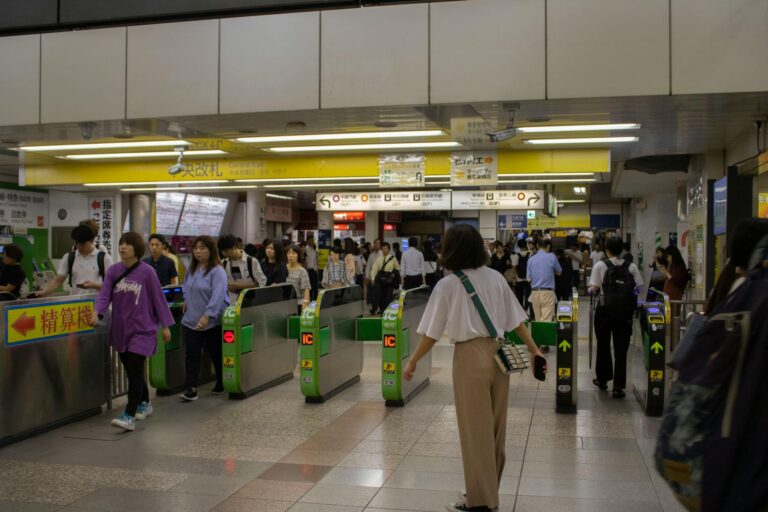
The train delivers you to Nikko. That’s the lower tier—the shrines, the cedars, the UNESCO complex at 600 meters elevation.
Quick answer: Yes, Canadians and Americans can drive in Japan with an International Driving Permit (IDP) from CAA or AAA. Get it before you leave — Japan does not issue IDPs to tourists. Rejection rates at rental counters are around 12%, almost always due to wrong IDP format.
Above it, separated by 48 switchbacks and 400 meters of vertical gain, lies a different world. Okunikko. The high plateau. Caldera lakes, alpine wetlands, sulfuric hot springs, cascades fed by the melting snows of Mount Nantai. A landscape that aligns more closely with the Japanese Alps than the suburban fringe of Tokyo.
The bus technically connects these tiers. The Tobu Bus runs from the station to Yumoto Onsen at the far end of the plateau. But the schedule creates a structural curfew that excludes you from the landscape’s most profound moments.
The first bus arrives at the Senjogahara Marshland around 7:15 AM. In summer, sunrise on the marsh is 4:25 AM. The morning mist—the asagiri that gives the region its mystical reputation—burns off by 6 AM. By the time the bus passenger arrives, the golden hour has passed, the mist has dissipated, and the boardwalks are filling with hikers.
The bus traveler sees the scenery. They’ve already missed the event.
Driving dissolves this constraint. The car isn’t just transportation in Okunikko—it’s a key that unlocks the temporal dimension of the landscape. To drive is to reclaim the dawn and the dusk, to witness Mount Nantai reflected in a glassy Lake Chuzenji before the first sightseeing boat has warmed its engines. For a different perspective on the lake, Lake Chuzenji kayak tours launch from the eastern shore and run through the autumn foliage corridor.
The Curfew: What the Bus Schedule Actually Excludes
The data is stark. Here’s what the bus timetable permits versus what the landscape offers:
Event Time Bus Access Sunrise (summer) 4:25 AM Impossible—first bus arrives ~7:15 AM Golden hour (AM) 4:30–5:30 AM Impossible Morning mist (asagiri) 4:00–6:00 AM Impossible Sunset (winter) 4:30 PM High risk—last buses depart shortly after Blue hour (PM) 7:30–8:00 PM Impossible Stargazing 9:00 PM+ Impossible—plateau is one of Kanto’s best dark-sky zones
The bus traveler experiences Okunikko between 9 AM and 5 PM—maximum crowd density, flat overhead light. The driver owns the landscape from 5 PM to 9 AM—sixteen hours where the plateau returns to silence and wildlife.
The Rental Strategy: Train to Nikko, Then Drive
You have two options: rent in Tokyo and drive the full distance, or take the train to Nikko and rent locally.
Canadian drivers: confirm your travel-medical policy covers you behind the wheel here before you pick up the keys.
The hybrid approach wins for most travelers.
Why not drive from Tokyo:
-
Highway tolls on the Tohoku Expressway add ¥3,000–4,000 each way
-
Tokyo traffic is unpredictable—escaping the sprawl can take 90 minutes alone
-
Highway driving is monotonous; you arrive fatigued before the mountain roads begin
The hybrid advantage:
-
Take the Tobu Spacia X or Limited Express from Asakusa—2 hours, guaranteed punctual, scenic and relaxing
-
Rental agencies (Nissan, Toyota, Nippon Rent-A-Car) cluster directly across from Tobu-Nikko Station
-
You arrive fresh, ready for the mountain driving that actually matters
-
Total transit cost for two people (~¥6,000–8,000) is often cheaper than tolls + gas from Tokyo
Vehicle selection matters: Avoid the “Kei car” trap. Those 660cc yellow-plate cars are perfect for cities but struggle on Irohazaka’s steep gradients. A fully loaded Kei car will have the engine screaming at 6,000 RPM, barely maintaining 40 km/h on the switchbacks. Upgrade to the Compact or Standard class (1.0L–1.5L engine)—Toyota Yaris, Honda Fit, Nissan Note e-Power. The cost difference is negligible (¥1,000–2,000/day) and the driving experience transforms entirely.
The IDP requirement is non-negotiable: Japan is draconian about the International Driving Permit. Rental agencies will absolutely deny the car without proper documentation. Geneva Convention nations (USA, UK, Australia, Canada) need the 1949 paper IDP issued in their home country. Switzerland, Germany, France, Belgium, Taiwan, and Monaco need an official JAF translation of their license. There is no “working something out” at the counter.
The Cinematic Ascent: Irohazaka Winding Roads
The gateway to the upper world is the Irohazaka—48 hairpin turns named after an ancient Japanese poem that uses each kana syllable exactly once. Each turn is labeled with its corresponding character.
For the driver, Irohazaka isn’t infrastructure. It’s an event.
The One-Way System
Unlike most mountain passes where traffic battles on narrow two-way lanes, Irohazaka is segregated by direction:
Second Irohazaka (ascent): Turns 1–20, climbing from Nikko to Lake Chuzenji. Two lanes, one-way. This configuration lets you take the racing line without fear of oncoming traffic. It encourages a rhythm, a flow state where you focus entirely on the climb.
Critical warning: The Akechidaira Observatory turnoff is accessible only from the ascending road. Once you pass it, you cannot turn back. You must complete the loop, descend the mountain, and climb again—over an hour detour.
First Irohazaka (descent): Turns 21–48, back down to Nikko. Tighter, steeper, demanding significant engine braking. The canyon walls create a “tunnel” effect during autumn foliage.
The Initial D Legacy
Irohazaka occupies special status in automotive culture thanks to the manga and anime Initial D, where the road serves as Team Emperor’s home course. The anime famously depicted drivers jumping hairpin turns—illegal, dangerous, and physically impossible due to guardrails, but the cultural legacy remains.
The road is maintained to high standard with banked curves and smooth tarmac. Even in a modest rental car, the DNA of the road communicates technicality and precision. Every hairpin is a familiar frame if you know the source material. The bus ride obscures this entirely; you’re a passenger in a large vehicle grinding through turns. Driving, you participate in the road’s history.
Timing the Drive
During peak autumn foliage (mid-October to early November), Irohazaka becomes a linear parking lot. The 20-minute drive decomposes into a 3-hour crawl. Bus passengers are trapped standing in crowded aisles, unable to exit.
The solution: Drive Irohazaka at 5:00 AM.
In October, the road is empty at this hour. As you ascend the Second Irohazaka, the sky lightens over the eastern mountains. By the time you reach Akechidaira near the summit, the sun is cresting the horizon, illuminating the Kegon Valley in gold while Nikko town below remains in shadow. Mist clings to the mountainsides. The road ahead is clear.
This is the driver’s privilege: engaging with the road before it becomes a utility for mass tourism.
Recommendation: Ascend no later than 6:30 AM during peak season. Stop at the Kurokamidaira lookout (often overlooked) for a view of the winding road you just conquered, then proceed to Akechidaira.
The High Plateau: What Opens Up
Once you’ve conquered Irohazaka, the divergence between driver and bus passenger widens dramatically.
The Chuzenji Skyline
Route 250 is an 8-kilometer winding road climbing the ridge south of Lake Chuzenji. Formerly a toll road, now free. It’s a dead-end terminating at Hangetsuyama—because it leads “nowhere,” public buses run here very infrequently, often only seasonally with massive schedule gaps.
Driving the Skyline offers aerial perspective of the lake impossible from the shore. The road rides the mountain spine, views into the rugged Ashio mountains on one side, the blue lake on the other. Sweeping curves, minimal traffic. A road built for driving pleasure.
Hangetsuyama: Two Distinct Views
At the Skyline’s terminus, drivers must understand the two experiences available:
The parking lot view: Looks away from the lake toward the Ashio mountains and layered Kanto ridges. Stark, rugged, beautiful—but not the classic postcard.
The observation deck: To see the iconic view of the Chuzenji peninsula (Hatcho Dejima) and Mount Nantai, you must hike. The trail climbs steeply for 0.6 km (20–30 minutes) from the parking lot corner.
The driver’s advantage: For a bus traveler, this hike is high-risk. Miss the infrequent return bus and you’re stranded on a remote ridgeline with no amenities. Schedule pressure ruins the tranquility.
The driver parks, changes into hiking shoes, hikes 30 minutes, spends an hour photographing the 360-degree panorama (Mount Fuji visible on clear days), and descends at leisure. The Hatcho Dejima peninsula cuts into the lake like a scythe—in autumn, a tapestry of reds and oranges against deep blue water. Widely considered the finest view in Nikko, and effectively inaccessible without a car.
Winter warning: The Chuzenji Skyline closes late November through mid-April. Hard limit—plan accordingly.
The Embassy Villas
The former Italian and British Embassy villas on Lake Chuzenji’s eastern shore are architectural gems—Western layouts with Japanese materials, built by diplomats who fell in love with Nikko’s resemblance to European landscapes.
British Embassy Villa: Built 1896. Wide verandas painted in black lacquer, designed to frame the lake view as living painting. Tea and scones in a room overlooking the water, replicating Meiji-era diplomatic lifestyle.
Italian Embassy Villa: Built 1928 by Antonin Raymond. Walls covered in geometric patterns of cedar bark—distinctly modernist, textured, sophisticated.
Access reality: The road directly to the villas is closed to private vehicles. But drivers park at Utagahama Parking Lot (free) and walk 10–15 minutes along the lakeshore. This “park-and-walk” makes the visit a viable 90-minute stopover.
Bus travelers face 30–40 minute walks from Chuzenji Onsen terminal or transfers to infrequent loop buses. The transit friction makes it a half-day commitment.
The Wetland at Dawn: Senjogahara
This is where the car advantage is absolute. Navigation apps are non-negotiable on the plateau — the boardwalk trails and parking areas don’t surface on standard maps unless you’re online. A Sakura Mobile eSIM keeps you connected without hunting for signal or relying on pocket WiFi battery life.
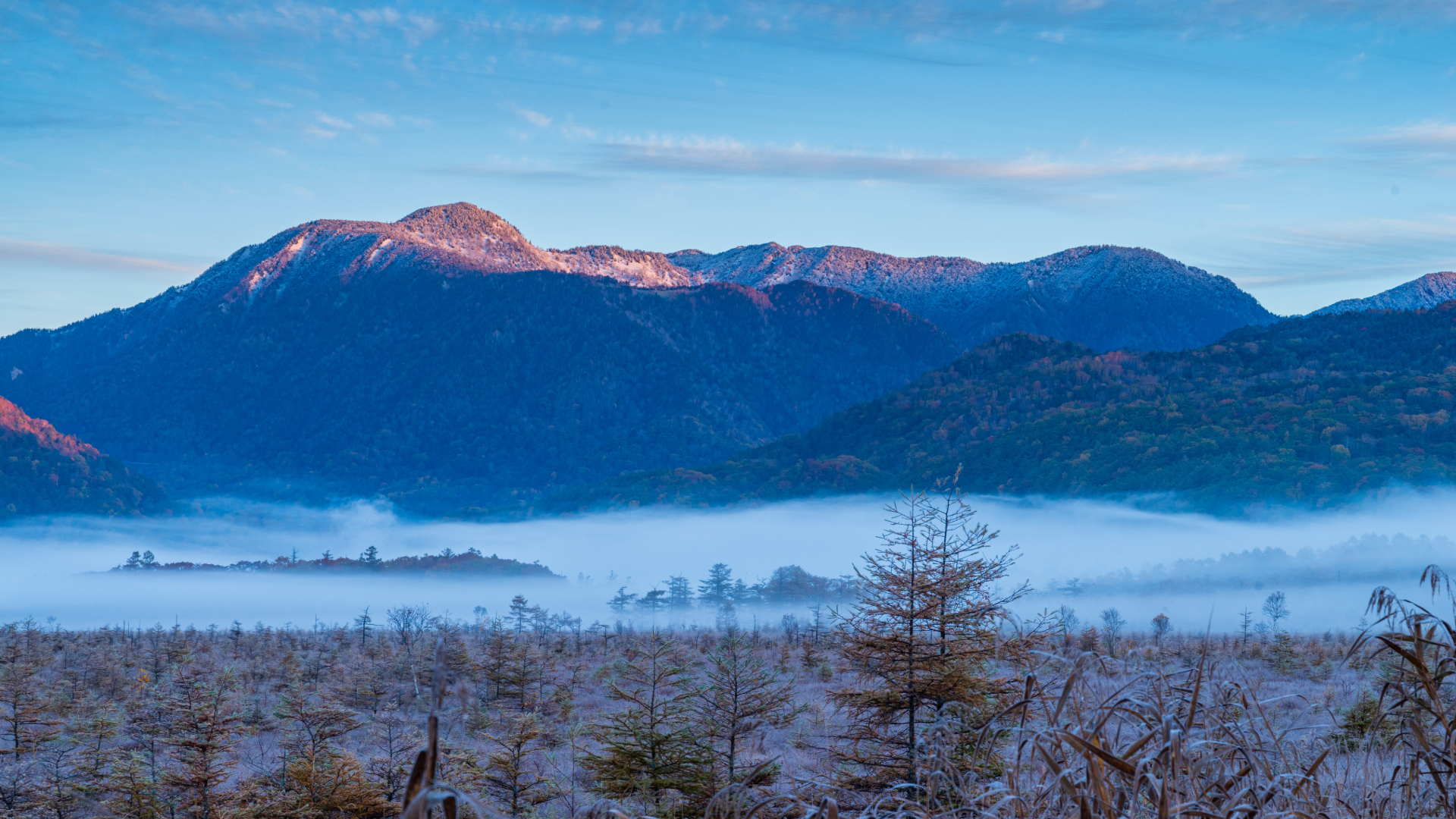
The Senjogahara Marshland—400 hectares of Ramsar-designated wetland at 1,400 meters—was once a mountain lake formed by Mount Nantai’s eruption. In daylight, it’s beautiful but busy. Before dawn, it’s otherworldly.
The Asagiri Phenomenon
On calm mornings, cool air sinks into the marsh basin, meeting warmer moisture from the wetland. Thick, rolling mist carpets the valley floor. As the sun rises over the external rim, it backlights the mist, turning dead larch trees into ghostly silhouettes against glowing white. The golden grasses catch first light—violent orange against the fog.
This peaks between 4:30 AM and 5:30 AM.
The first bus arrives at 7:13 AM. The magic is gone.
The Dawn Patrol Protocol
Sanbonmatsu Parking Area: Your strategic base. Free parking for 100+ cars on Route 120. Restrooms open 24 hours—vital for pre-dawn arrivals.
The viewpoint: Directly across from the parking lot, the Sanbonmatsu Observation Deck offers a wide, elevated view of the marsh with Mount Nantai in the background. Wheelchair accessible, no hiking required. This is the spot for the classic sunrise photo—mountain reflecting dawn light above the mist layer.
Akanuma Parking Area: The trailhead for the nature boardwalks. Park here at 4:30 AM. Enter the trail.
At this hour, the boardwalks are empty. You’ll encounter Sika deer grazing in the mist, breath visible in cold air. The silence is absolute—broken only by marsh warblers or distant woodpecker hammering.
Walking here at 5:00 AM is solitary communion with nature. Walking here at 10:00 AM is dodging school groups and tour guides.
Odashirogahara: The Hybrid Approach
West of Senjogahara lies a smaller enclosed marsh famous for a single Japanese white birch—”The Lady of Odashirogahara”—standing alone in the field.
Private vehicles are banned on the access road to protect the environment. The hybrid electric bus starts around 8 AM—too late for sunrise photographers.
The driver’s solution: Park at Akanuma and hike the 2km trail through Mongolian oak forest in the dark. Flat, easy terrain. Arrive at the Odashirogahara observation deck before dawn to see “The Lady” emerging from mist, often with hoarfrost on her branches in late autumn.
The car gets you to the trailhead. The bus doesn’t.
The Detours: What Flexibility Unlocks
The car enables micro-detours impossible to justify on an hourly bus schedule.
Urami Falls: The Forgotten Cascade
Once considered one of Nikko’s three great waterfalls, Urami has fallen off the tourist radar. Bus access requires a 2.5km (45-minute) uphill walk from the main road stop.
Drivers navigate directly to the Urami Falls parking lot (free). From there, a 500-meter hike up a stone path to the 45-meter cascade. A shrine to Fudo Myoo sits near the basin.
Visit Urami, enjoy the solitude, return to the main road in 40 minutes. Impossible by bus.
Kirifuri Highlands: The Sky Corridor
East of Nikko, a separate toll-free road climbs to Kirifuri Highland—completely different driving character from the technical Irohazaka. Wide, sweeping, high-speed curves.
At the top: the “Tenku Kairo” (Corridor in the Sky), a 1,445-step staircase climbing a former ski slope. The view from the summit reaches the Tokyo Skytree 100km away and the Pacific Ocean on clear days.
Continuing north: Ozasabokujo Farm, a working farm famous for fresh soft-serve ice cream and Jingisukan (grilled mutton). Pastoral, open atmosphere—stark contrast to the enclosed forests around the shrines.
Kanmangafuchi Abyss
Seventy stone Jizo statues (Bake-Jizo) along the Daiya River, wearing red bibs and caps. Legend says if you count them walking one way and count again walking back, the numbers never match—hence “Ghost Jizo.”
Public transit requires a confusing walk through residential streets from Tamozawa bus stop. Drivers use the small free lot at Kanman Park (40 spaces). If it’s full, swing by later—flexibility the bus traveler doesn’t have.
Yumoto Onsen: The End of the Road
The far western terminus. Hot spring town on the shores of Lake Yunoko. The air smells of sulfur drifting from the gensen (source springs) where hot water bubbles out of wooden enclosures.
The freedom of the car: stay for a sunset soak, drive back down the mountain in darkness using headlights, while bus passengers have long since fled to catch the last connection.
Seasonal Realities
Winter (December–March)
Okunikko transforms into snow country. Yumoto becomes a ski resort area. Monochromatic, silent, starkly beautiful.
Tire mandate: Specify “Snow Tires” (Studless) when booking. In Kanto, these are often a paid add-on, not standard equipment. Driving Irohazaka on summer tires in January is suicidal and illegal. The agency may refuse the car if snow tires aren’t reserved.
Black ice: Roads around the lake and in Irohazaka’s shadows are prone to black ice. 4WD capability (Subaru Forester, Nissan X-Trail) is highly recommended over 2WD compacts.
Road closures: Route 120 to Gunma (Konsei Pass) closes in winter. The Chuzenji Skyline closes. Winter drivers are limited to the Irohazaka-Chuzenji-Yumoto corridor. But the closure of peripheral roads means the remaining areas are incredibly quiet—solitude summer visitors never see.
Autumn (October)
Colors descend the mountain: early October at Ryuzu Falls and Yumoto (high elevation), late October on Irohazaka and the shrines (lower).
Traffic strategy: Commit to an alpine start (pre-dawn) to enjoy the driving. Once on the plateau, stay there. Do not descend to Nikko town for lunch—you’ll lose hours. Bring supplies or eat lakeside. Descend only after dark.
The Summary
The bus traveler visits a list of stops: Kegon Falls, the Lake, the Shrine. They see them in flat midday light, surrounded by others doing the exact same loop. They’re consumers of a pre-packaged itinerary, bounded by transit shift times.
The driver visits a living landscape. They see steam rising from Yumoto’s sulfur vents at midnight. They watch sunrise paint the marshland grass in violent orange while the rest of the world sleeps. They feel the G-force of the Irohazaka turns, participating in the road’s history rather than being transported over it.
Location Bus Constraint Driver’s Advantage Senjogahara Arrives ~7:15 AM (misses sunrise) Arrival at 4:30 AM for asagiri and sunrise Irohazaka Trapped in traffic, no stops Control departure (5 AM), stop at Akechidaira Akechidaira Accessible only on ascent, missed by direct buses Guaranteed access, free parking for sunrise Hangetsuyama Infrequent/seasonal, risky hike timing Drive to lot, leisurely hike, stay as long as needed Odashirogahara Dependent on 8 AM hybrid bus Drive to Akanuma trailhead pre-dawn, hike in Urami Falls 45-min walk from bus stop Drive directly to trailhead (500m walk) Winter access Risk of freezing while waiting Warm shelter, flexibility (must have snow tires)
Tools That Help
Book compact for the mountain roads above Nikko.
Airalo eSIM — Navigation is non-negotiable on plateau roads. Install before departure. Japan plans from ~$5.
In Okunikko, the high plateau exists for those willing to drive to it. The car dissolves the curfew. It grants the rarest luxury in modern tourism: the ability to be alone in a crowded place, simply by arriving when the timetable says no one else can.